Lanhai Targeting · Mineral exploration · New South Wales
AI for mineral exploration.
Lanhai builds AI for mineral exploration. We are building Lanhai Targeting, a deep-learning model that learns from Australia's open geoscience data to rank where new copper-gold deposits are most likely, with every target traceable to the data behind it. Baseline v0 is live today.
Lanhai Targeting · Lachlan Orogen window · Baseline v0Model v1 · In development
copper recordgold recordranked cell · top 20 outlinednamed deposit
Live todayBaseline v0 on 8,031 public records, 3,914 of them Cu/Au/Ag/Mo
RegionLachlan Orogen, copper-gold, New South Wales
DataGeological Survey of NSW · Geoscience Australia · AuScope
PrototypeBaseline v0 on public dataLive
Deep-learning modelLearns from geophysical grids and imageryIn development
NVIDIAPyTorch + CUDA on NVIDIA GPUs · RAPIDS · PhysicsNeMoNext
Product
Targets you can trace back to the data.
An exploration team gets a ranked grid of cells and, for every cell, the evidence that put it there. A geologist can audit the ranking before anyone drills. Targets are a starting point for field work, not a claim about what is in the ground.
01 · Open data
Public layers, one grid
GSNSW occurrences, geology, DIGS
GA magnetics, gravity, radiometrics
ASTER and Sentinel-2 imagery
02 · Model · in development
Learns the signature of known deposits
Will read stacked grids and imagery
To be trained around known Cu-Au deposits
To be evaluated by holding out known deposits
03 · Targets
Ranked cells, reasons attached
Score and the layers that drove it
Nearest known deposits, mapped geology
A starting point for field work
Next · field results feed the next model
Prototype today
Baseline v0: a transparent ranking on public data.
Before training anything, we built the simplest honest baseline: a 0.1° grid over the Lachlan Orogen window, scored by the copper, gold, silver and molybdenum records within 15 km of each cell, excluding the records inside the cell itself. Deposits weigh three, occurrences one. The score is a density prior, nothing more.
8,031public records in the window
3,914Cu · Au · Ag · Mo records
133Cu 768Audeposit records, copper and gold
1,295cells of 0.1°, 1,014 scored
9 of 20top cells containing a Cu or Au deposit record
19.5%of all cells contain one, for comparison
Window 146.5–150.2°E · 31.5–35.0°S · Geological Survey of NSW, WFS 2.0, pulled 1 November 2026 · Method and reproduction steps
It does what a prior does: it re-finds the historical goldfields around West Wyalong and Temora. That is the point. A ranking built on where people already dug cannot find new ground, which is why the model in development learns from magnetics, gravity, radiometrics and imagery instead.
Baseline check, not model performance. A cell's own records are excluded from its score; records in neighbouring cells within 15 km are not, so this is a weak check, not a hold-out. We publish it so the deep-learning model has a number to beat. Open the prototype to click any cell and see the records behind its score.
Data
Built on Australia's open geoscience data.
No private data is needed to start. Each layer is public; Baseline v0 uses the first one, the model in development uses all of them. Public inputs mean public checks: anyone can re-run a Lanhai ranking against the same records.
Source
Layers
Licence
Status
Geological Survey of NSW
Mineral occurrence records (MinView, WFS 2.0), seamless geology, DIGS exploration reports, drill-hole data
CC BY 4.0
Occurrences in Baseline v0
Geoscience Australia
Airborne magnetics, gravity and radiometric grids, Geophysics Reference Data Collection on NCI
CC BY
In development
AuScope NVCL
Hyperspectral drill-core mineralogy, nationwide
Open
Next
Satellite imagery
ASTER and Sentinel-2 alteration indices
Open
In development
Prior work we build on
2019 · Geological Survey of NSW & Kenex
Weights-of-evidence porphyry copper-gold model for the Macquarie Arc: evidence layers weighted statistically against known deposits. Same public inputs we use.
2024 · EarthByte, University of Sydney
Lachlan-wide random-forest models over 300 features at 0.01°. For copper, magnetic grids and intrusive boundaries carried the most signal. Presented at the NSW Government's Exploration in the House.
Next · Lanhai
Deep learning on the raw grids: convolutional and transformer models that read the grids directly, with physics-informed inversion added later. That is the product in development.
Technology
Where the GPUs go.
Prospectivity at 0.01° across a state is an image problem over hundreds of stacked layers. Training that is GPU work; the rest of the pipeline is designed to move there too. Next: convolutional models over the stacked grids, trained with PyTorch and CUDA on NVIDIA A100 cloud GPUs; the feature stack rebuilt with NVIDIA RAPIDS; then physics-informed inversion of magnetics and gravity with NVIDIA PhysicsNeMo.
01 · Ingest
Open-data lake
Grids, vectors and reports pulled from public portals, tiled to one grid.
Live · occurrences
02 · Features
NVIDIA RAPIDS
Derivatives, filters and spatial joins over hundreds of layers with cuDF and cuSpatial.
Next
03 · Train
PyTorch + CUDA on NVIDIA GPUs
Convolutional and transformer models over stacked grids and imagery, evaluated by holding out known deposits.
Next
04 · Physics
NVIDIA PhysicsNeMo
Physics-informed inversion of magnetic and gravity data, so the model sees structure, not only texture.
Next
05 · Reports
NVIDIA NIM
Later: an assistant over DIGS exploration reports, so each target also cites what earlier explorers wrote.
Later
What the model sees
The stack in, the structure out.
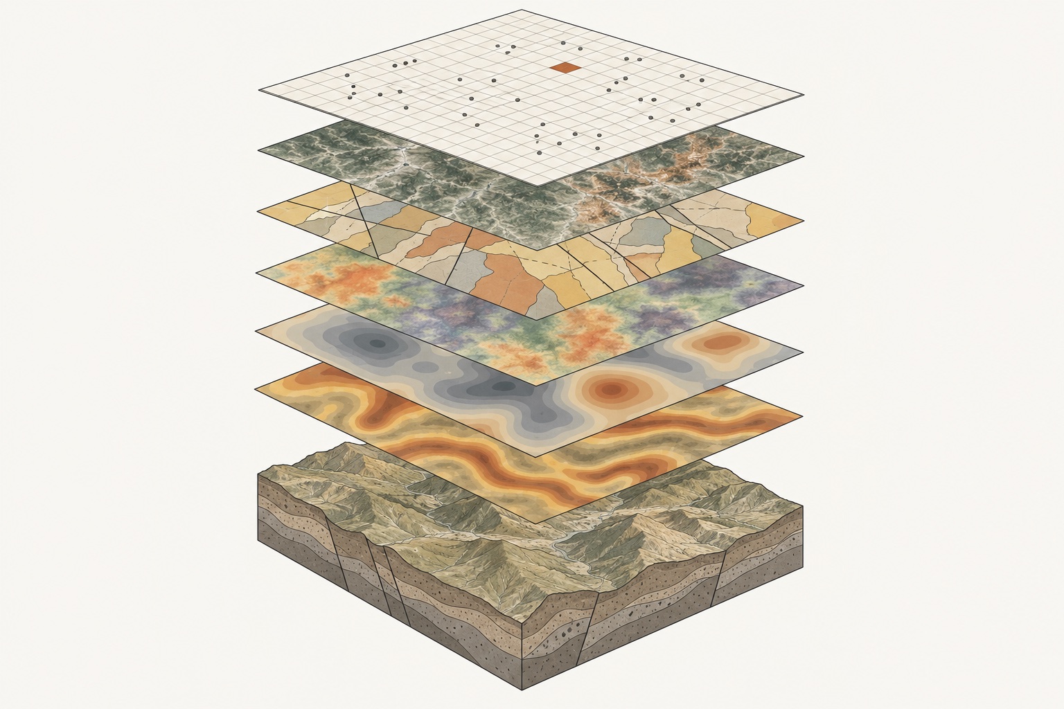
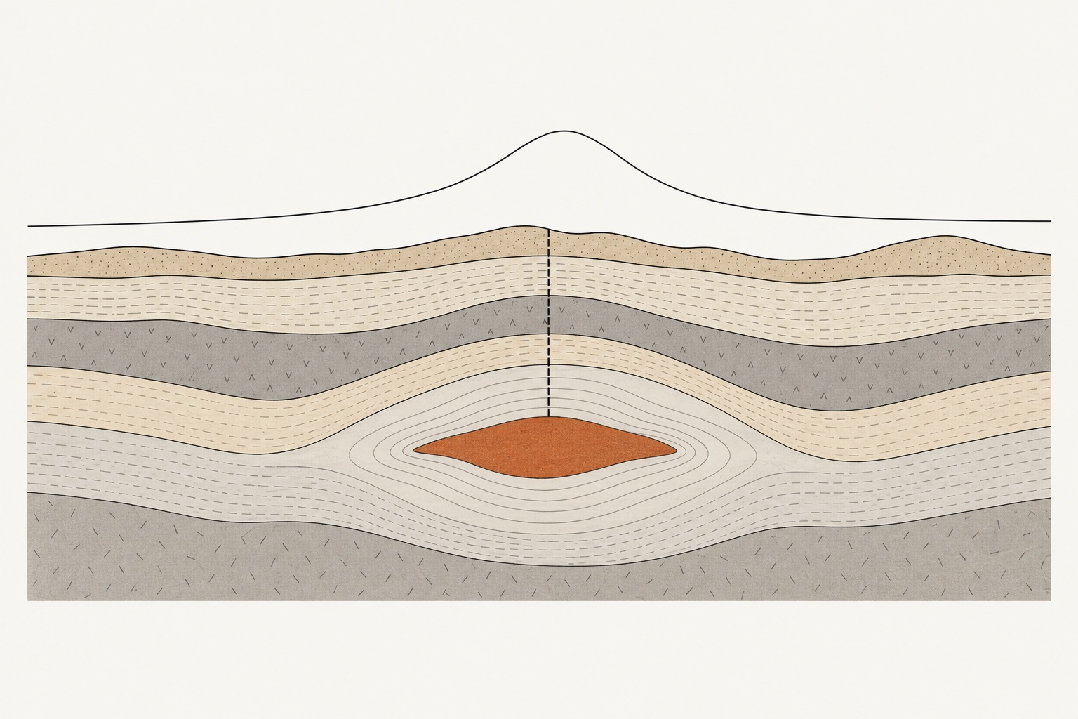
Concept illustrations of the two things in development: the single 0.01° stack the model reads, and the depth structure that physics-informed inversion recovers from magnetics and gravity. Not model output, not real data; the real Baseline v0 map is above.
Input · one stack. Occurrence records, satellite alteration, geology with faults, radiometrics, gravity and magnetics on one grid over the terrain. ConceptDepth · inversion. A magnetic anomaly at surface and the body that explains it at depth, recovered with NVIDIA PhysicsNeMo and fed back into training. Concept
Company
Built by BLUE OCEAN (LANHAI) PTY LTD.
A New South Wales company incorporated in August 2024. Lanhai Targeting is the company's product, built for explorers working the Lachlan Orogen.